Identification and location
Qasr Qarun corresponds to ancient Dionysias, a locality of the meris of Themistos, at the western end of the Faiyum. The site lies about 3.5 kilometres from Birket Qarun, the remnant of ancient Lake Moeris; the name Qasr Qarun also refers to a neighbouring village. Founded shortly before 229/228 BC, perhaps under Ptolemy III, the town takes its name from Dionysus, whose cult was favoured by the Lagid dynasty, although no particular ruler can be named as its founder. It remained occupied until the 6th century AD. The written evidence, mainly papyri, ostraca and inscriptions, amounts to more than 260 mentions in nearly 200 texts, from the late 3rd century BC to the 6th century AD.
An oval town with parallel streets
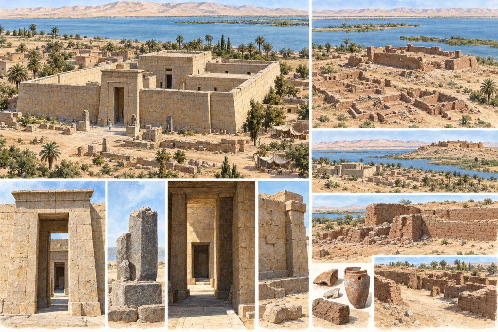
The settlement covers about 32 hectares. Oval in plan, it is crossed lengthwise by three streets that form a grid; occupation never seems to have been very dense. Few buildings stand more than a metre and a half high. Besides a stone kiosk and a brick building interpreted as a Roman mausoleum, three bath buildings have been identified. The southernmost comprised several rooms and a caldarium with ten individual seats, later converted into a single basin. The second, circular, measured 6 metres in internal diameter and 8 metres externally, with 18 seats. The third, already badly damaged by the sebbakhin in 1948, has never been excavated.
The temple of Sobek
The limestone temple measures 26.8 × 18.8 metres, with a maximum preserved height of 9.47 metres; it was dedicated to Sobek. Its dromos, lined with two stone lions (one entered the Alexandria museum in 1934, the other was found in 1948), was paved in the 2nd or 1st century BC, the probable date of the temple’s construction. To the south-east stood a processional station, perhaps accompanied by a Roman-period deipneterion, a banqueting hall. Paola Davoli points out that the ground-floor plan of the temple of Soknopaios at Soknopaiou Nesos (Dimeh) differs little from that of Dionysias, whose dimensions it also shares; the two buildings differ mainly in the naos and in the number and position of the crypts. The Egyptian Ministry of Tourism and Antiquities draws attention every 21 December to the alignment of the sun’s rays with the sanctuary. The temple was restored in 1957.
The castra Dionysiados
The Roman camp, measuring 83 × 70 metres, is built of mudbrick on a stone footing, with walls 3.8 metres thick. Projecting square towers occupy the corners and the western curtain wall, U-shaped towers the other sides; a postern opens at the north-west corner. Inside, 52 barrack blocks line a central street with a double colonnade leading to a raised complex, whose apse, set into the thickness of the rampart, yielded a statue attributed to Nemesis. The camp, which could house some 300 soldiers, was home, according to the Notitia Dignitatum, to the ala quinta praelectorum, a unit also known from the archive of the officer Flavius Abinnaeus. Materials of the 1st to 3rd centuries were reused in it. An ostracon of AD 306 refers to castra being rebuilt: major works are therefore attested under the Tetrarchy, but the date of the original construction remains debated. The camp was probably abandoned around AD 400.
A counterfeiters’ workshop
In 1950, a partly ruined house yielded about 15,000 terracotta coin moulds, thrown away after use. It stands halfway between the temple and the camp, about a hundred metres east of the latter. Stacks of moulds, intact casting assemblies, metal waste and failed coins were recovered there. Dated to the early 4th century AD, under Constantine I, they form the largest group known in Egypt. Kept in the stores of the Institut français d’archéologie orientale (IFAO, French Institute of Oriental Archaeology), they are being studied by Pierre-Marie Guihard, Jérémie Chameroy and Guillaume Blanchet (CRAHAM, University of Caen Normandy, and LEIZA in Mainz).
From Jomard to the Siena mission
Edme Jomard described and drew the temple in the Description de l’Égypte (1821); Grenfell and Hunt searched there in vain for papyri in 1898–1899. The Franco-Swiss mission of Jacques Schwartz and Henri Wild, with A. Badawy and R. Smith, surveyed the camp in 1948 and then excavated it from 7 October to 16 November 1950, beneath 2 to 3 metres of sand; its reports were published by the IFAO in 1950 and 1969. Since 2009, the Dionysias Archaeological Project of the University of Siena (Emanuele Papi) has surveyed about 16 hectares with non-invasive methods. The little attention paid to stratigraphy in 1948–1950 still limits the detailed chronology of the town.
Sources
Main sources (consulted on 30 September 2026): Peter Van Minnen, ‘Dionysias (meris of Themistos)’, Fayum Project, Trismegistos, KU Leuven; Michel Reddé, ‘Retour sur les castra Dionysiados’, UNA Éditions (in French); Les moules monétaires de Qasr Qarun/Dionysias, CRAHAM, University of Caen Normandy (in French); Paola Davoli, ‘L’attività archeologica’, in Venti anni di Papirologia a Lecce, University of Salento, 2012 (in Italian).