In brief
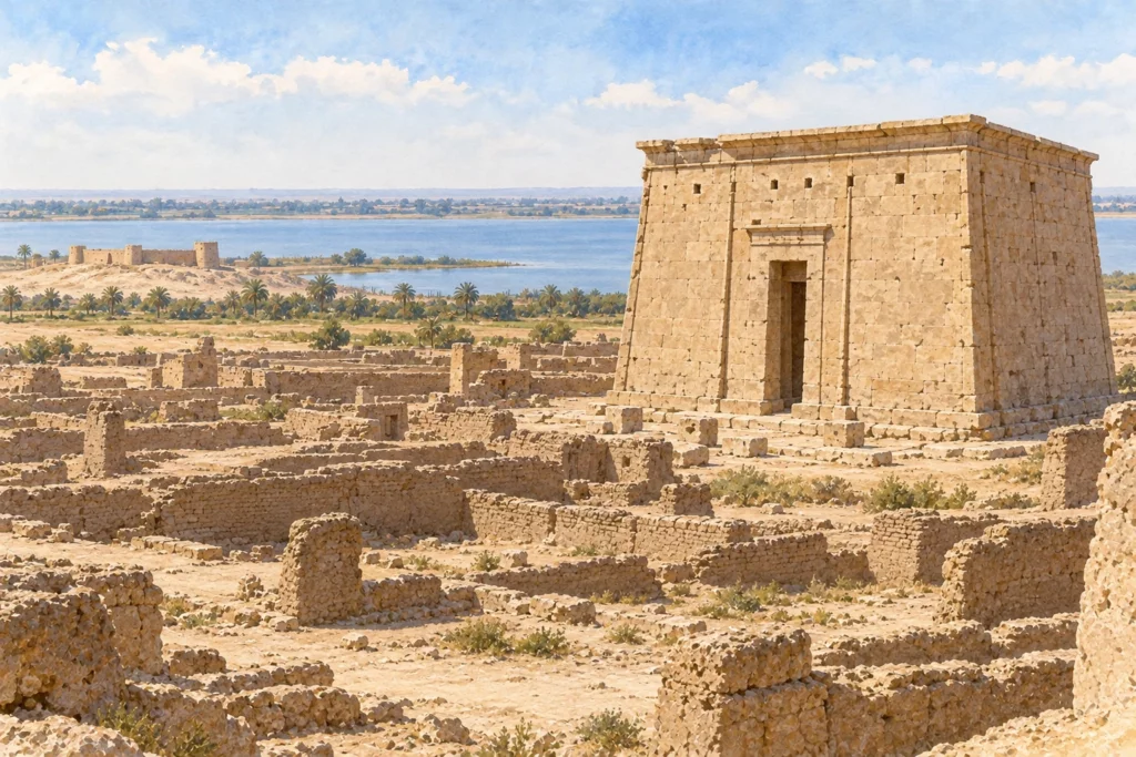
Qasr Qarun, ancient Dionysias, occupies the western end of the Faiyum, about 3.5 kilometres from Birket Qarun, the salt lake that survives from ancient Lake Moeris. The town was founded in the Ptolemaic period, shortly before 229/228 BC, and its name refers to Dionysus, a god particularly honoured by the Ptolemies. It remained inhabited until the 6th century AD. On the edge of the desert, it now brings together a stone temple, a mudbrick town and a Roman military camp.
What you discover
The temple catches the eye first. Built of limestone and dedicated to Sobek, the crocodile god worshipped throughout the Faiyum, it measures about 27 by 19 metres and still rises to 9.47 metres. Around it, the town formed an oval of some thirty hectares, cut lengthwise by three streets. Its mudbrick houses are heavily levelled: few buildings stand more than a metre and a half high. A small stone kiosk, a brick building interpreted as a Roman mausoleum and bathing installations can still be made out.
Further off, a rectangle of mudbrick walls of about 83 by 70 metres marks the Roman camp. Built in the time of the Tetrarchy, it housed, according to the Notitia Dignitatum, a cavalry unit, the ala quinta praelectorum. Its projecting towers and its barracks lined up on either side of a central street with a double colonnade make it a landmark of late antique military architecture.
What to look at
The temple is best read along its axis. A paved dromos led to it, flanked by two stone lions: one entered the Alexandria museum in 1934, the other was found on site in 1948. The paving of this avenue, attributed to the 2nd or 1st century BC, gives the most likely date for the construction of the temple itself. Every year on 21 December, at the winter solstice, the sun’s rays align with the sanctuary, a phenomenon highlighted by the Egyptian Ministry of Tourism and Antiquities.
Another detail belongs to economic history. In a building halfway between the temple and the camp, the excavators collected in 1950 some 15,000 terracotta coin moulds of the early 4th century AD, thrown away after use. It is the largest group of its kind known in Egypt, and it bears witness to an unofficial production of small change in a period of inflation.
Its history
Travellers of the 18th and 19th centuries came mainly for the temple. Edme Jomard, a member of the French expedition to Egypt, published a description and drawings of it in 1821 in the Description de l’Égypte. Bernard Grenfell and Arthur Hunt passed through in 1898–1899 in search of papyri, without success. The only real excavations were those of the Franco-Swiss mission of Jacques Schwartz and Henri Wild, in 1948 and 1950. The temple was restored in 1957. Since 2009, the University of Siena, under the direction of Emanuele Papi, has been studying the town with non-invasive methods, topographic, magnetic and geophysical surveys, over about 16 hectares.
Several questions remain. The early excavations paid little attention to stratigraphy, which limits the dating of the quarters. The construction date of the camp is still debated: an ostracon of AD 306 mentions castra being rebuilt, but the exact chronology of the work has not been settled.
Sources
Consulted on 30 September 2026: Peter Van Minnen, ‘Dionysias (meris of Themistos)’, Fayum Project, Trismegistos, KU Leuven; Qaṣr Qārūn (Dionysias), 4CARE database, MF Norwegian School of Theology, Religion and Society; The Solar alignment every year, Egyptian Ministry of Tourism and Antiquities.