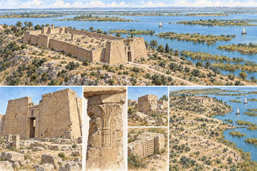
Identification and location
Taposiris Magna corresponds to the site of Abusir, Plinthine to Kom el-Nugus, on the northern shore of Lake Mareotis (Lake Mariout), 45 kilometres west of Alexandria. The two settlements extend over the slopes of the Pleistocene sandstone ridge, the taenia, which separates the Mediterranean from the lake depression; they are 2.2 kilometres apart as the crow flies, Plinthine to the east. The satellite site of Rahim lies 900 metres from Plinthine, near the lake. The identification of Taposiris is secured by inscriptions, including a statue base found by Evaristo Breccia in 1905–1906, bearing a dedication to Isis by the priests of Taposiris. That of Plinthine, with no written document found on the spot, rests on the topography and on the classical texts (the gulf of Plinthine in Herodotus, the invention of the vine in Hellanicus).
Plinthine, a kom from the New Kingdom to the Hellenistic period
The kom was occupied at least from the 18th and 19th Dynasties; a stela dedicated by Seti II has been found there. In the centre of the kom (sector 7), the foundations of a large stone building are interpreted as those of a temple. In 2019, ten hieroglyphic inscriptions were discovered there, two of them in the name of Ramses II (Ramesses II); seven blocks in sunk relief, bearing his cartouches and cut in the local stone, suggest that a temple was built on the spot or nearby during his reign. Levels of the 8th century BC have been reached, then a dense occupation of the Saite-Persian period (7th to 5th century BC), with a residential district and the wine press discovered in 2016 in sector 6, the best preserved of the pharaonic period. In the Hellenistic period, a vast trench destroyed most of the earlier levels for the installation of a large rectangular building, identified as a temple and dismantled in the Roman period. A Ptolemaic wine-making villa of 14.35 × 14.46 m, built around a wine press, was abandoned at the end of the Ptolemaic period. The Hellenistic necropolis, a kilometre to the west, measures about 100 × 50 m and has fewer than a hundred tombs, used at least in the 3rd and 2nd centuries BC.
Taposiris, the western gate of Egypt
Taposiris developed from the beginning of the Hellenistic period until its abandonment at the end of the 7th or the beginning of the 8th century AD. The upper town brings together the temple of Osiris and the Breccia terrace, where tholos baths, a necropolis of mummified animals and a peristyle house stand side by side. The Tower of the Arabs is the tomb of a Hellenistic notable reproducing the lighthouse of Alexandria at a quarter or a fifth of its size. In AD 41, Claudius placed Taposiris among the gates of Egypt; a Wall of the Barbarians barred the ridge and an enclosed harbour controlled lake traffic. In the Byzantine period, the town was rebuilt on the remains of the early Empire and the harbour was refitted; an aristocratic house excavated in 1975 by an American team was dated to the 6th century AD in 2022.
From Breccia to the French mission
The maps of the French expedition to Egypt already record at Taposiris a ‘square enclosure’ (translated from the French) and the Tower of the Arabs. Breccia explored the terrace in 1905–1906 and published his results in 1914; Achille Adriani carried out a brief season at Plinthine in 1937. The French mission to Taposiris Magna and Plinthine (MFTMP) was founded in 1998 by Marie-Françoise Boussac, who directed it until 2018. It is now co-directed by Bérangère Redon (CNRS, HiSoMA) and Joachim Le Bomin (Institut français d’archéologie orientale, IFAO, French Institute for Oriental Archaeology). It works with the Egyptian Ministry of Tourism and Antiquities, the IFAO and the French Ministry for Europe and Foreign Affairs.
Farmland, frontier and threats
The mission studies viticulture, ancient farmland, urban hydraulics and the Byzantine-Islamic transition at Taposiris. A monograph on the Saite-Persian levels of Plinthine was submitted to the IFAO press in 2025. The construction of a motorway over Lake Mariout is rapidly destroying harbour remains, which the mission is documenting by aerial photography.
Sources
Main sources (consulted on 30 September 2026): Taposiris Magna and Plinthine, Institut français d’archéologie orientale (in French); Bérangère Redon et al., ‘Taposiris Magna et Plinthine (2019)’, Bulletin archéologique des Écoles françaises à l’étranger, OpenEdition (in French); Bérangère Redon, Joachim Le Bomin et al., ‘Taposiris Magna et Plinthine (2024)’, Bulletin archéologique des Écoles françaises à l’étranger, OpenEdition (in French).