Identification and location
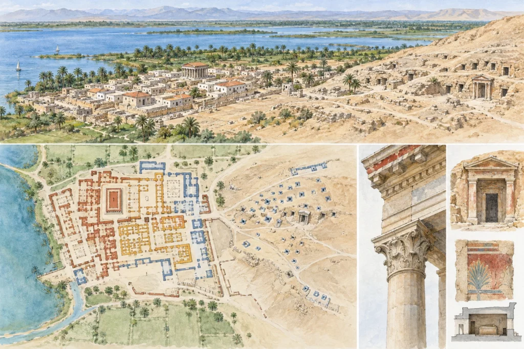
Philadelphia (Greek Philadelpheia) corresponds to the western part of Kom el-Kharaba el-Kebir, also called Gharabet el-Gerza, in the north-eastern corner of the Faiyum. The site overlooked a trade route linking the Faiyum to the Nile valley and ending at Kerke, present-day Girza. It covers about 2 kilometres from north to south and 1.5 kilometres from east to west; the modern Bahr Wahbi canal separates it on the west from the cultivated land, and the Girza road divides it into a northern and a southern zone.
A Ptolemaic foundation
Philadelphia is one of the foundations created under the first Ptolemies along a new irrigation network. According to Katelijn Vandorpe, the village was founded, or transformed by the addition of a new residential quarter, around 259 BC, in honour of the late Queen Arsinoe II. It remained administered as a village in the Hellenistic and Roman periods and fell into oblivion around the beginning of the 5th century AD. The material collected on the surface shows that the 2nd century and the middle of the 1st century BC are the best-represented periods, the 2nd and 3rd centuries AD less so.
Zenon and the estate of Apollonios
In November or December 259 BC, the dioiketes Apollonios, the chief financial administrator of Ptolemy II, received in the Arsinoite nome an estate of 10,000 arouras, about 2,750 hectares. Zenon, born around 285 BC at Kaunos, in Caria, was first his agent and private secretary, then the manager of this estate at Philadelphia. His archive comprises 1,819 certain texts, dated from 263 to 229 BC, mainly in Greek, with ten Demotic and fourteen bilingual texts. Brought to light by sebakh diggers, the first documents appeared on the market in 1911; most were sold from about 1914, a large lot entering the Egyptian Museum in Cairo and the rest being dispersed among European and American collections.
An orthogonal plan at ground level
The only early excavation, carried out in 1908–1909 by Paul Viereck and Friedrich Zucker for the Berlin museums, was limited to the north-west of the southern zone; Ludwig Borchardt drew from it, only in 1924, a schematic plan consistent with an aerial view by the Royal Air Force from 1925. The mission directed by Ruey-Lin Chang for the IFAO and the Austrian Academy of Sciences has been working on the site since 2015. Geomagnetic survey has revealed craft quarters to the south and fired-brick buildings along the ancient canal. In 2018, foundation trenches cut into the rock along the cardinal axes confirmed the orthogonal plan; two kilns of the second half of the 3rd century BC yielded the earliest Faiyum production of amphorae in the Rhodian style. To the north, a vast complex may have served as a storehouse and a basin as a fishpond; to the south, mudbrick elevations suggest a wall, near former limestone quarries.
The necropolis and the Er-Rubayyat portraits
The mummy portraits discovered in the 19th century and known as the Er-Rubayyat or Philadelphia portraits have no archaeological context. Over six seasons, an Egyptian mission has distinguished in the necropolis phases of occupation from the 3rd century BC to the 4th century AD; the last two seasons yielded a complete portrait and fragments in a stratified context, published in 2022 in BIFAO. These data should help to date the portraits kept in museums and to test their provenance.
Sources
Sources (consulted on 30 September 2026): Philadelphie, Institut français d’archéologie orientale (in French); Katelijn Vandorpe, ‘Zenon son of Agreophon’, Trismegistos Archives (KU Leuven), 2013; Basem Gehad, Lorelei H. Corcoran et al., ‘Newly Discovered Mummy Portraits from the Necropolis of Ancient Philadelphia, Fayum’, BIFAO 122, 2022.