Identification and location
This article mainly concerns the valley temple linked to the Bent Pyramid of Sneferu, in the south of Dahshur, together with traces of settlement associated with the royal complexes of the same reign. It belongs to the 4th Dynasty, in the 27th or 26th century BC depending on the chronologies. The southern temple lay near the eastern edge of the desert, at the end of a causeway coming from the pyramid. The settlements documented near this temple and the workers’ installations sought near the Red Pyramid, to the north, must be distinguished in space and in function. The title of this entry groups these remains together to show how the complexes worked, without designating a single monument or a town whose entire plan is known.
General presentation
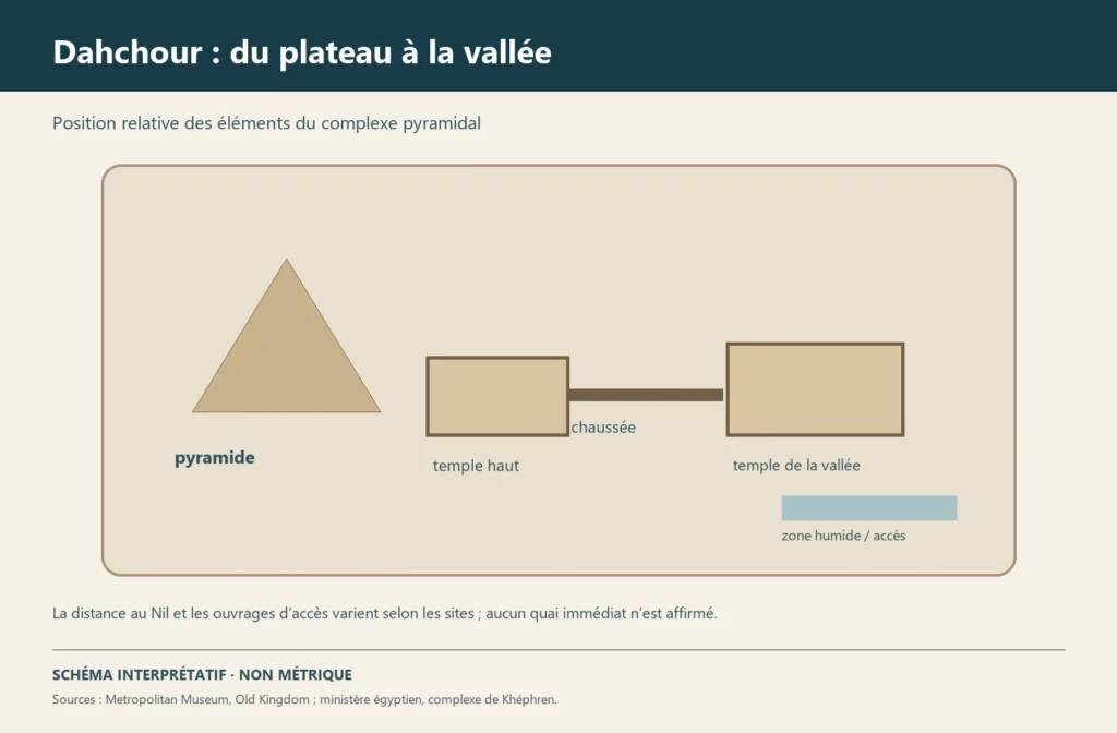
The Bent Pyramid dominated a complex articulated between the funerary plateau and the valley. The causeway made the link with the valley temple, a building involved in the royal cult and in the movement of people and offerings. The carved fragments from the temple make this sector an early and important witness to the decoration of pyramid complexes. The neighbouring houses and activity areas recall the daily occupation of the place. Further north, the Red Pyramid had its own environment of work and worship; the archaeological data there are of a different nature. The study of Dahshur thus benefits from combining architecture, reliefs, pottery, geophysical survey and the analysis of the ancient landscape.
Monuments and remains
The southern temple is known mainly from its foundations and scattered blocks, rather than from an intact elevation. Ahmed Fakhry discovered many relief fragments there during his excavations in the 1950s. Some were kept in storage for decades; their cleaning, restoration and drawing have resumed as part of recent research. They document the decoration but do not allow all the walls to be reconstructed without gaps. The causeway ran from the Bent Pyramid towards the eastern edge of the desert. Studies of its lower course and trial trenches east of the temple have provided evidence of an ancient approach by water, notably a wall interpreted as linked to a harbour. The mudbrick houses known around the temple are not a complete town preserved in the open. Near the Red Pyramid, magnetic surveys have covered areas interpreted as workers’ installations. Sneferu’s northern village has also been located beneath several metres of deposits; these data must not be projected onto the southern temple.
Chronology and building phases
The monumental programme goes back to the reign of Sneferu. The construction of the causeway and the temple belongs to the development of the complex of the Bent Pyramid, but not all their stages are dated individually. The cult and the occupation may have continued after the end of the royal building work. Stone robbing affected the buildings: the research of the German Archaeological Institute notes in particular a route for transporting blocks reused in the New Kingdom, associated with the dismantling of the valley temple. Relief fragments were found there. The landscape of the valley has also changed through deposits and the shifting of channels, which complicates the identification of the ancient approaches. The settlement levels near the Red Pyramid belong to another sequence of works and occupation; merging them into a single urban phase would be unjustified.
History and functions
The valley temple, placed between the spaces of the pyramid and the routes of the plain, was part of the cult arrangement of the dead king. The reliefs represented the sovereign and his relations with the gods and the resources of the kingdom; the fragments, however, give only part of the programme. The causeway structured the route through the landscape. The nearby houses suggest the presence of people attached to the tasks of the complex, though the identity of each occupant cannot be read in the walls. For the Old Kingdom, the term ‘pyramid town’ may exaggerate the known size of these settlements: UCL points out that some are attested only by a few houses. The work installations near the Red Pyramid tell us about the material organisation of Sneferu’s reign and must not be turned into a fully reconstructed residential district.
Excavations and the history of research
The research of William Matthew Flinders Petrie at Dahshur in the 19th century contributed to general knowledge of the necropolis. Ahmed Fakhry played a central role in exploring the southern complex in the 1950s; his excavations yielded a large corpus of reliefs from the valley temple. The German Archaeological Institute in Cairo has resumed the study of the sector, notably the survey of the lower causeway, the documentation of the fragments, the restoration of objects kept in storage and magnetic surveys around the temple. Trial trenches have sought the ancient limits between desert and valley and confirmed the existence of a wall interpreted as linked to an eastern harbour. The 2015 surveys also covered the workers’ installations near the Red Pyramid. These results offer data of various kinds: excavated reliefs, geophysical anomalies and isolated trenches do not have the same degree of precision for reconstructing a plan.
State of preservation and research questions
The temple has lost most of its elevation, and the corpus of reliefs remains fragmentary. Their reassembly and study may change the reading of the decoration. The houses and work areas are known only in sectors; the real extent of the occupation remains to be clarified. The hypothesis of an ancient harbour and the shape of the plain in Sneferu’s time depend on geoarchaeological investigation and cannot be read directly in the modern landscape. A central question is how to connect the evidence without confusing the contexts of the Bent Pyramid and the Red Pyramid. The discovery image for this article is a created illustration of the ruins and the route towards the valley.
Sources
Main sources: German Archaeological Institute, project ‘Der Pyramidenfriedhof von Dahschur’ (in German), https://www.dainst.org/forschung/projekte/noslug/2772; German Archaeological Institute, Dahshur report 2014–2015, https://publications.dainst.org/journals/efb/article/view/1534; German Archaeological Institute, study of the reliefs of the valley temple, https://publications.dainst.org/journals/efb/article/download/1688/4585; UCL Digital Egypt, ‘Pyramid towns’, https://www.ucl.ac.uk/museums-static/digitalegypt/pyramids/town.html; UCL Digital Egypt, ‘Dahshur’, https://www.ucl.ac.uk/museums-static/digitalegypt/dahshur/bentpyramid.html.