Identification and location
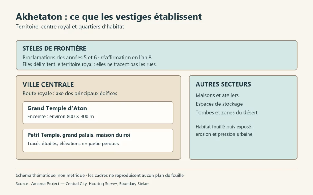
Ancient Akhetaten occupied a plain on the east bank of the Nile, framed by cliffs. The boundary stelae defined a territory larger than the built-up quarters visible today, including areas on the other bank. The Amarna Project distinguishes in particular the Central City, the Main City, suburbs, funerary areas and desert installations. Using ‘Amarna’ for all these places without further detail erases their diversity and the questions specific to each sector.
General presentation
The ‘Central City’ is a modern label. It brought together the two main temples of the Aten, the Great Palace, the King’s House and numerous administrative installations. The Royal Road provided an axis of composition for the buildings facing it. The residential quarters extended beyond this monumental core. The sizes and forms of the houses varied; the surviving plans do not justify the image of a wholly uniform city or one built in a single campaign.
Monuments and remains
The brick enclosure of the Great Aten Temple bounded an area of about 800 × 300 metres. It included vast open spaces as well as the Long Temple and a sanctuary further back. The latter, 48 × 32 metres according to the Amarna Project, went through several successive arrangements. The Small Aten Temple had its own enclosure, of about 191 × 111 metres. The Great Palace ran along the Royal Road on the river side; its decoration of faience, alabaster and painted floors often survives only as fragments. These figures refer to documented structures, not to a complete reconstruction of the elevations.
Chronology and building phases
The proclamations carved on the boundary stelae are dated to years 5 and 6 of Akhenaten, then supplemented by a reaffirmation in year 8. They make it possible to follow the formulation of the royal project, but they do not date each house or each repair. In the Great Temple, traces of planting pits and of a brick base precede the known layout of the sanctuary. At the end of the Amarna period, other buildings were still being added or altered. The capital was then abandoned as a centre of power and the stone of the major buildings was salvaged.
History and functions
The city was not limited to the ceremonies of the Aten. Near the Great Temple, ovens, bread moulds, labelled jars and storage areas provide information on the preparation of offerings and the redistribution of food. The house of the high priest Panehsy, service buildings and the palace storerooms point to a complex administration. The reliefs in the tombs show royal ceremonies and journeys; they complement the remains, but their pictorial language should not be read as a photograph of each building.
Excavations and the history of research
John Pendlebury and the Egypt Exploration Society cleared much of the Central City in the 1930s. The stones of the great buildings had often disappeared, but their gypsum foundation beds retained impressions useful for recording the plans. The Amarna Project compares these early observations with new fieldwork. In the Main City, a programme of surveys and photogrammetry is also revisiting the houses excavated in the early 20th century and left exposed. The archives of the first campaigns remain essential for understanding what has changed since they were opened.
State of preservation and research questions
The shallowness of the deposits, the erosion of the brick walls, the spread of modern housing and the local rise in groundwater threaten the residential areas. Protective walls, digital surveys and conservation measures are proposed by the Amarna Project. In the centre, the reuse of stone has erased the superstructures, while the foundations sometimes give very precise information about their footprint. An honest plate must distinguish the attested outline of a building, its interpreted use and the hypothetical appearance of its upper parts.
Sources
Main sources (consulted on 28 September 2026): https://www.amarnaproject.com/amarna-the-place/central-city/; https://www.amarnaproject.com/our-work/excavation-and-survey/housing-survey/; https://www.amarnaproject.com/amarna-the-place/boundary-stelae/.