In brief
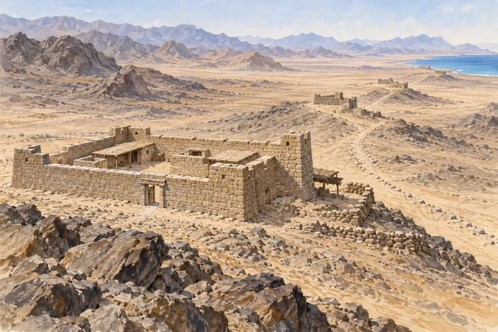
Between the Nile and the Red Sea, the Romans lined the tracks of the Eastern Desert with small fortified posts, the praesidia. On the road from Coptos (today Quft) to the port of Berenike, a complete network of fortified wells was set up from AD 76/77, under Vespasian, when the prefect of Egypt Iulius Ursus, returning from Berenike, indicated where new water points should be dug. Between Coptos and Phoinikon (al-Laqita), this road shared its course with that of Myos Hormos, the other great port of the Red Sea.
What you discover
Each post generally takes the form of a small fort or quadrangular fortified village, built of dry stone around a well. At Didymoi, water was raised by a hydraulic machine whose terracotta buckets have been found, and four cisterns were built over time. In front of the gate there is almost always a rubbish dump: this is where the garrisons threw their waste, and it is where most of the known texts come from. Some forts almost merge into the landscape: Xeron Pelagos, ‘Dry Sea’, a small post of 44 by 33 metres, is so silted up by the flash floods of the wadi that it can barely be distinguished from the neighbouring rocky outcrops. The posts differ in size, date and plan, and none can serve as an exact model for all the others.
What to look at
The most telling detail is found at Dios (Abu Qurayya). In a former barracks, an oracular chapel had been fitted out: a platform decorated with a rustic stone marquetry carried the divine statues. Statues, sundial and votive inscriptions, in Greek and Ge’ez, are of steatite, a soft rock quarried 500 metres north of the fort. About ten oracles in Greek, numbered and attributed to various deities, have been found on sherds, and the fragment of sundial bears the strange inscription ‘zone of the unfortunate’.
These inscribed sherds, the ostraca, are the real wealth of the road. Private letters, ration lists, guard rotas, messages of the military post: they document the daily life of soldiers and civilians, but they remain ephemeral writings, not the official archives, which went back to the Nile Valley.
Its history
The Berenike road was first followed by caravans that took on water at widely spaced wells; a graffito of 4 BC, in the rock shelter of the paneion of the Wadi Minayh, is the oldest dated evidence of its use. From around the AD 50s, it supplanted that of Myos Hormos for trade. Researchers link the construction of the forts to the increase in nomadic raids reported by ostraca of Trajan and Hadrian, but this explanation remains a hypothesis. In the 3rd century, the army had reached an arrangement with the nomads, who came to the posts for supplies and received rations of wine there. The forts still in service were abandoned around the middle of the 3rd century.
Today, off-road vehicle tourism, illicit digging and the machinery of nearby mines and quarries are rapidly damaging these fragile structures. The exact routes between the water points remain partly uncertain, especially as the ancient itineraries and the ostraca do not always agree on the names of the stations.
Sources
Consulted on 30 September 2026: The Roman praesidia of the Eastern Desert, Institut français d’archéologie orientale (in French); François Kayser, review of H. Cuvigny (ed.), Didymoi. Une garnison romaine dans le désert Oriental d’Égypte, Revue des études anciennes 114/2, 2012, Persée (in French).